
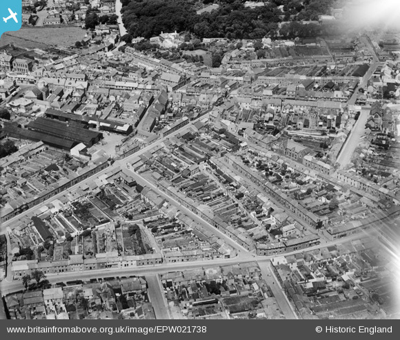
EPW021738 ENGLAND (1928). Union Street and environs, Camborne, 1928
© Copyright OpenStreetMap contributors and licensed by the OpenStreetMap Foundation. 2026. Cartography is licensed as CC BY-SA.
Nearby Images (18)
EPW021738

EAW033645

EPW039768

EPW039770

EPW059671

EPW021735

EAW027858

EAW027859

EAW027857

EAW027860

EPW059670

EPW009888

EPW009886

EPW009887

EPW021737

EPW009934

EPW021736

EPW021739

Details
| Title | [EPW021738] Union Street and environs, Camborne, 1928 |
| Reference | EPW021738 |
| Date | 24-June-1928 |
| Link | |
| Place name | CAMBORNE |
| Parish | CAMBORNE |
| District | |
| Country | ENGLAND |
| Easting / Northing | 164897, 40011 |
| Longitude / Latitude | -5.2956915946712, 50.212697971884 |
| National Grid Reference | SW649400 |
