
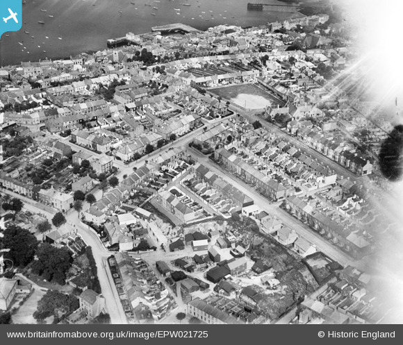
EPW021725 ENGLAND (1928). Trelawney Road and the town, Falmouth, 1928
© Copyright OpenStreetMap contributors and licensed by the OpenStreetMap Foundation. 2026. Cartography is licensed as CC BY-SA.
Nearby Images (3)
EPW021725

EPW009870

EPW009869

Details
| Title | [EPW021725] Trelawney Road and the town, Falmouth, 1928 |
| Reference | EPW021725 |
| Date | 24-June-1928 |
| Link | |
| Place name | FALMOUTH |
| Parish | FALMOUTH |
| District | |
| Country | ENGLAND |
| Easting / Northing | 180627, 32520 |
| Longitude / Latitude | -5.0712147295708, 50.151458820016 |
| National Grid Reference | SW806325 |
Pins
Be the first to add a comment to this image!