
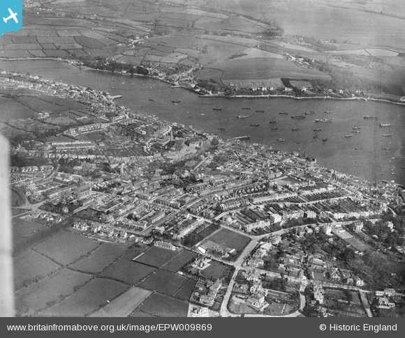
EPW009869 ENGLAND (1924). The town centre and Penryn River, Falmouth, from the south-west, 1924
© Copyright OpenStreetMap contributors and licensed by the OpenStreetMap Foundation. 2026. Cartography is licensed as CC BY-SA.
Nearby Images (3)
EPW009869

EPW009871

EPW021725

Details
| Title | [EPW009869] The town centre and Penryn River, Falmouth, from the south-west, 1924 |
| Reference | EPW009869 |
| Date | March-1924 |
| Link | |
| Place name | FALMOUTH |
| Parish | FALMOUTH |
| District | |
| Country | ENGLAND |
| Easting / Northing | 180507, 32291 |
| Longitude / Latitude | -5.0727602383338, 50.149357613983 |
| National Grid Reference | SW805323 |
Pins
Be the first to add a comment to this image!