
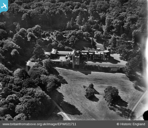
EPW021711 ENGLAND (1928). Caerhays Castle, Caerhays, 1928
© Copyright OpenStreetMap contributors and licensed by the OpenStreetMap Foundation. 2026. Cartography is licensed as CC BY-SA.
Nearby Images (2)
EPW021711

EPW021710

Details
| Title | [EPW021711] Caerhays Castle, Caerhays, 1928 |
| Reference | EPW021711 |
| Date | 24-June-1928 |
| Link | |
| Place name | CAERHAYS |
| Parish | ST. MICHAEL CAERHAYS |
| District | |
| Country | ENGLAND |
| Easting / Northing | 197123, 41593 |
| Longitude / Latitude | -4.8454289329959, 50.238839989459 |
| National Grid Reference | SW971416 |
Pins
Be the first to add a comment to this image!
User Comment Contributions

Caerhays Castle |

Robert - Cumbria |
Wednesday 27th of June 2012 06:31:28 PM |