
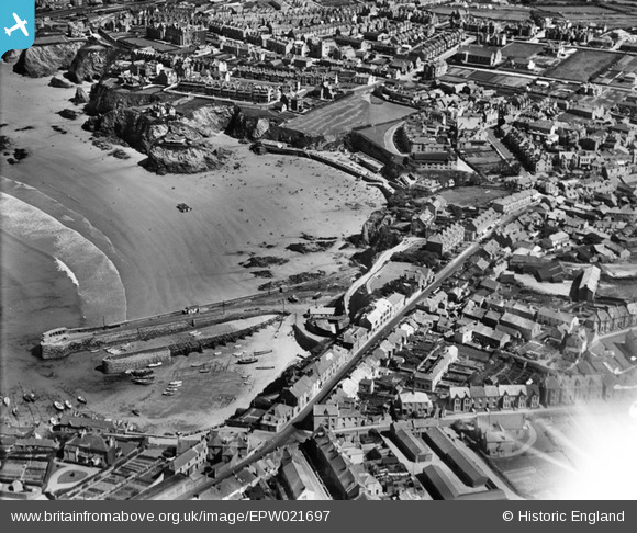
EPW021697 ENGLAND (1928). Towan Beach, South Pier and the town, Newquay, 1928
© Copyright OpenStreetMap contributors and licensed by the OpenStreetMap Foundation. 2026. Cartography is licensed as CC BY-SA.
Nearby Images (4)
EPW021697

EAW031037

EPW039799

EAW031038

Details
| Title | [EPW021697] Towan Beach, South Pier and the town, Newquay, 1928 |
| Reference | EPW021697 |
| Date | 24-June-1928 |
| Link | |
| Place name | NEWQUAY |
| Parish | NEWQUAY |
| District | |
| Country | ENGLAND |
| Easting / Northing | 180865, 61917 |
| Longitude / Latitude | -5.0849232858477, 50.415573283134 |
| National Grid Reference | SW809619 |
Pins

MB |
Saturday 17th of August 2013 06:37:07 PM | |
|
MB |
Tuesday 25th of June 2013 01:25:52 PM | |
|
D J Ellery |
Tuesday 11th of December 2012 09:14:32 PM | |
Allen T |
Tuesday 9th of October 2012 08:07:04 PM | |
Allen T |
Tuesday 9th of October 2012 08:06:13 PM | |
Allen T |
Tuesday 9th of October 2012 08:05:05 PM | |
Allen T |
Tuesday 9th of October 2012 07:59:53 PM | |
The central quay has the old wooden quay which carried goods to and from the railway station via the "Trams". The tunnel onto the harbour is still there. |
D J Ellery |
Tuesday 11th of December 2012 09:11:09 PM |

Class31 |
Saturday 22nd of September 2012 01:27:55 PM |