
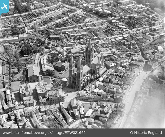
EPW021662 ENGLAND (1928). St Mary's Cathedral and the town centre, Truro, 1928
© Copyright OpenStreetMap contributors and licensed by the OpenStreetMap Foundation. 2026. Cartography is licensed as CC BY-SA.
Nearby Images (8)
EPW021662

EPW021657

EPW021663

EAW027882

EAW027883

EAW027881

EPW021659

EPW021664

Details
| Title | [EPW021662] St Mary's Cathedral and the town centre, Truro, 1928 |
| Reference | EPW021662 |
| Date | 24-June-1928 |
| Link | |
| Place name | TRURO |
| Parish | TRURO |
| District | |
| Country | ENGLAND |
| Easting / Northing | 182602, 44913 |
| Longitude / Latitude | -5.0507007551268, 50.263497334452 |
| National Grid Reference | SW826449 |
Pins

Class31 |
Tuesday 23rd of July 2013 09:33:58 AM | |
This "Square" is known as High Cross |

valpb |
Friday 23rd of August 2013 05:22:23 PM |
 |
Class31 |
Tuesday 23rd of July 2013 09:06:17 AM |
|
Class31 |
Tuesday 23rd of July 2013 09:04:09 AM | |
|
Class31 |
Tuesday 30th of October 2012 10:27:51 PM | |
|
Class31 |
Tuesday 30th of October 2012 10:24:59 PM |


User Comment Contributions

Square by the west front of the Cathedral. |
Class31 |
Tuesday 23rd of July 2013 09:35:53 AM |
Shops in Pydar Street looking south west. |
Class31 |
Tuesday 23rd of July 2013 09:10:29 AM |

Truro Methodist Church |
Class31 |
Tuesday 23rd of July 2013 09:07:25 AM |

The Cathedral looking west from St. Mary's Street |
Class31 |
Monday 22nd of July 2013 10:09:51 PM |

St. Mary's Street looking east. |
Class31 |
Monday 22nd of July 2013 10:08:09 PM |

The Cathedral from High Cross |
Class31 |
Monday 22nd of July 2013 10:06:22 PM |

View north of the Cathedral. |
Class31 |
Monday 22nd of July 2013 10:04:29 PM |
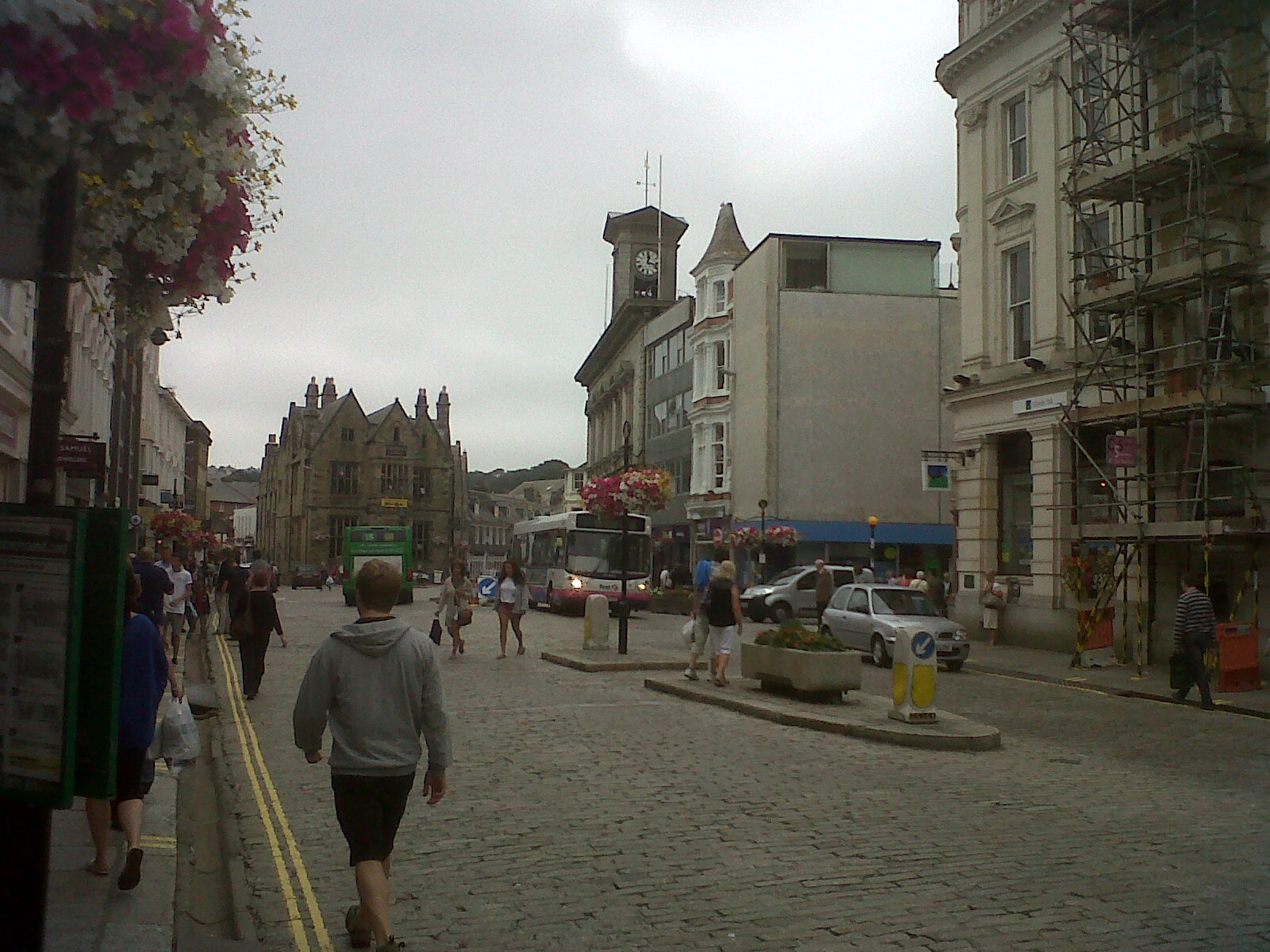
View east of Boscawen Street. |
Class31 |
Monday 22nd of July 2013 10:02:34 PM |