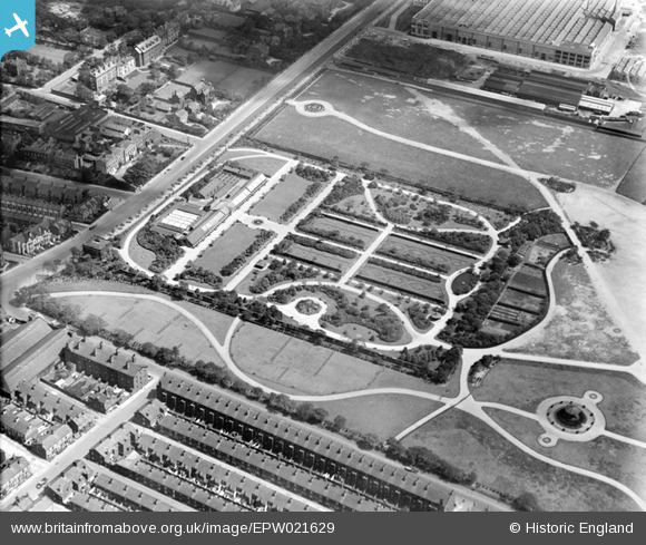
EPW021629 ENGLAND (1928). Wavertree Botanic Gardens, Liverpool, 1928
© Copyright OpenStreetMap contributors and licensed by the OpenStreetMap Foundation. 2026. Cartography is licensed as CC BY-SA.
Details
| Title | [EPW021629] Wavertree Botanic Gardens, Liverpool, 1928 |
| Reference | EPW021629 |
| Date | June-1928 |
| Link | |
| Place name | LIVERPOOL |
| Parish | |
| District | |
| Country | ENGLAND |
| Easting / Northing | 337432, 390454 |
| Longitude / Latitude | -2.9412908349566, 53.406928224608 |
| National Grid Reference | SJ374905 |


![[EPW021629] Wavertree Botanic Gardens, Liverpool, 1928](http://britainfromabove.org.uk/sites/all/libraries/aerofilms-images/public/100x100/EPW/021/EPW021629.jpg)
![[EPW021631] Wavertree Botanic Gardens, Liverpool, 1928](http://britainfromabove.org.uk/sites/all/libraries/aerofilms-images/public/100x100/EPW/021/EPW021631.jpg)
![[EPW021630] Wavertree Botanic Gardens, Liverpool, 1928](http://britainfromabove.org.uk/sites/all/libraries/aerofilms-images/public/100x100/EPW/021/EPW021630.jpg)
![[EPW021628] Wavertree Botanic Gardens and Park, Liverpool, 1928](http://britainfromabove.org.uk/sites/all/libraries/aerofilms-images/public/100x100/EPW/021/EPW021628.jpg)

