
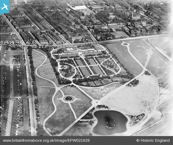
EPW021628 ENGLAND (1928). Wavertree Botanic Gardens and Park, Liverpool, 1928
© Copyright OpenStreetMap contributors and licensed by the OpenStreetMap Foundation. 2026. Cartography is licensed as CC BY-SA.
Nearby Images (4)
EPW021628

EPW021631

EPW021629

EPW021630

Details
| Title | [EPW021628] Wavertree Botanic Gardens and Park, Liverpool, 1928 |
| Reference | EPW021628 |
| Date | June-1928 |
| Link | |
| Place name | LIVERPOOL |
| Parish | |
| District | |
| Country | ENGLAND |
| Easting / Northing | 337447, 390423 |
| Longitude / Latitude | -2.9410590543235, 53.406651362909 |
| National Grid Reference | SJ374904 |
Pins
Be the first to add a comment to this image!
User Comment Contributions
The streets & roads are Botanic Road tothe left of pic.Along top is Edge Lane.Off Edge Lane from left is Needham Road,Bradfield St.Botanic Place,Deane Road,and Beech St.I was born in Botanic Place(1950).Edge Lane has been widened from Botanic Road towards the city centre(to the leftof pic.) |

ken |
Sunday 1st of July 2012 11:18:12 PM |