
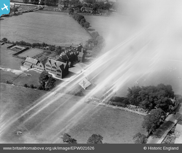
EPW021626 ENGLAND (1928). Sandbach Grammar School, Sandbach, 1928
© Copyright OpenStreetMap contributors and licensed by the OpenStreetMap Foundation. 2026. Cartography is licensed as CC BY-SA.
Nearby Images (8)
EPW021626

EPW021621

EAW037078

EAW037076

EAW037080

EAW037081

EAW037077

EAW037079

Details
| Title | [EPW021626] Sandbach Grammar School, Sandbach, 1928 |
| Reference | EPW021626 |
| Date | June-1928 |
| Link | |
| Place name | SANDBACH |
| Parish | SANDBACH |
| District | |
| Country | ENGLAND |
| Easting / Northing | 375321, 360682 |
| Longitude / Latitude | -2.3689889946226, 53.142421996333 |
| National Grid Reference | SJ753607 |
Pins
Be the first to add a comment to this image!