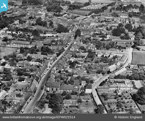
EPW021514 ENGLAND (1928). Bridge Street and environs, Downham Market, 1928
© Copyright OpenStreetMap contributors and licensed by the OpenStreetMap Foundation. 2025. Cartography is licensed as CC BY-SA.
Nearby Images (7)
Details
| Title | [EPW021514] Bridge Street and environs, Downham Market, 1928 |
| Reference | EPW021514 |
| Date | June-1928 |
| Link | |
| Place name | DOWNHAM MARKET |
| Parish | DOWNHAM MARKET |
| District | |
| Country | ENGLAND |
| Easting / Northing | 560921, 303187 |
| Longitude / Latitude | 0.37648461030397, 52.602247903547 |
| National Grid Reference | TF609032 |
Pins

Wissey |
Tuesday 4th of February 2025 05:48:13 PM | |

volvoRman |
Friday 13th of December 2013 04:59:08 PM | |
Lynda Tubbs |
Tuesday 3rd of December 2013 03:04:07 PM | |

Mike B |
Sunday 23rd of September 2012 04:08:55 PM | |

Mike B |
Sunday 23rd of September 2012 04:07:46 PM | |

Mike B |
Sunday 23rd of September 2012 04:06:18 PM | |

Mike B |
Sunday 23rd of September 2012 04:05:21 PM | |

Mike B |
Sunday 23rd of September 2012 04:04:17 PM |


![[EPW021514] Bridge Street and environs, Downham Market, 1928](http://britainfromabove.org.uk/sites/all/libraries/aerofilms-images/public/100x100/EPW/021/EPW021514.jpg)
![[EAW031884] The town, Downham Market, 1950](http://britainfromabove.org.uk/sites/all/libraries/aerofilms-images/public/100x100/EAW/031/EAW031884.jpg)
![[EAW031886] The town, Downham Market, 1950](http://britainfromabove.org.uk/sites/all/libraries/aerofilms-images/public/100x100/EAW/031/EAW031886.jpg)
![[EPW021463] The Town Centre, Downham Market, 1928](http://britainfromabove.org.uk/sites/all/libraries/aerofilms-images/public/100x100/EPW/021/EPW021463.jpg)
![[EAW031887] The town, Downham Market, 1950](http://britainfromabove.org.uk/sites/all/libraries/aerofilms-images/public/100x100/EAW/031/EAW031887.jpg)
![[EPW021516] Clackclose School, Downham Market, 1928](http://britainfromabove.org.uk/sites/all/libraries/aerofilms-images/public/100x100/EPW/021/EPW021516.jpg)
![[EPW021517] The town centre, Downham Market, 1928](http://britainfromabove.org.uk/sites/all/libraries/aerofilms-images/public/100x100/EPW/021/EPW021517.jpg)