
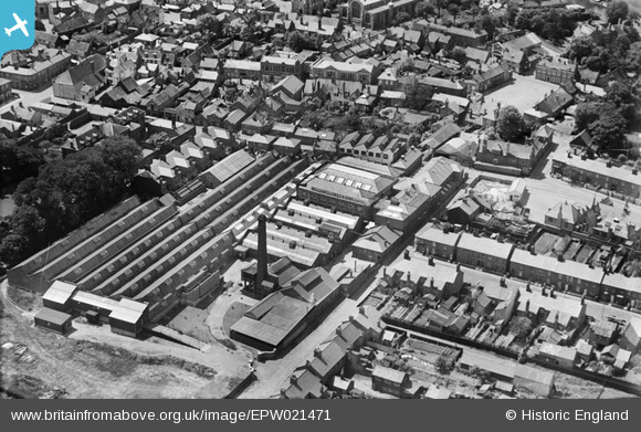
EPW021471 ENGLAND (1928). Caxton Printing Works, Beccles, 1928
© Copyright OpenStreetMap contributors and licensed by the OpenStreetMap Foundation. 2026. Cartography is licensed as CC BY-SA.
Nearby Images (18)
EPW021471

EPW046872

EPW046879

EPW046873

EPW046875

EPW046876

EPW046874

EPW046878

EPW021461

EPW046877

EPW021467

EPW021468

EPW049111

EPW021469

EPW021462

EPW046900

EPW021460

EPW021470

Details
| Title | [EPW021471] Caxton Printing Works, Beccles, 1928 |
| Reference | EPW021471 |
| Date | June-1928 |
| Link | |
| Place name | BECCLES |
| Parish | BECCLES |
| District | |
| Country | ENGLAND |
| Easting / Northing | 642275, 290575 |
| Longitude / Latitude | 1.5666166624791, 52.458909153864 |
| National Grid Reference | TM423906 |
Pins
Be the first to add a comment to this image!