
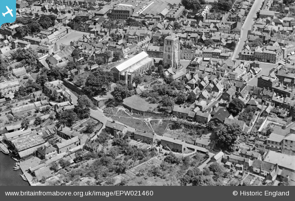
EPW021460 ENGLAND (1928). St Michael's Church, Beccles, 1928
© Copyright OpenStreetMap contributors and licensed by the OpenStreetMap Foundation. 2026. Cartography is licensed as CC BY-SA.
Nearby Images (12)
EPW021460

EPW046900

EPW021462

EPW021470

EPW021469

EPW021467

EPW021461

EPW046872

EPW021471

EPW046873

EPW046875

EPW046879

Details
| Title | [EPW021460] St Michael's Church, Beccles, 1928 |
| Reference | EPW021460 |
| Date | June-1928 |
| Link | |
| Place name | BECCLES |
| Parish | BECCLES |
| District | |
| Country | ENGLAND |
| Easting / Northing | 642058, 290448 |
| Longitude / Latitude | 1.5633367203057, 52.457865697511 |
| National Grid Reference | TM421904 |
Pins
Be the first to add a comment to this image!