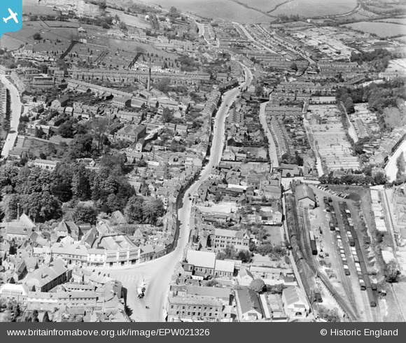
EPW021326 ENGLAND (1928). High Street and the town, Chesham, 1928
© Copyright OpenStreetMap contributors and licensed by the OpenStreetMap Foundation. 2025. Cartography is licensed as CC BY-SA.
Nearby Images (6)
Details
| Title | [EPW021326] High Street and the town, Chesham, 1928 |
| Reference | EPW021326 |
| Date | 27-May-1928 |
| Link | |
| Place name | CHESHAM |
| Parish | CHESHAM |
| District | |
| Country | ENGLAND |
| Easting / Northing | 496058, 201912 |
| Longitude / Latitude | -0.60965341488609, 51.707252728965 |
| National Grid Reference | SP961019 |
Pins

John W |
Monday 9th of August 2021 03:23:50 PM | |

John W |
Monday 9th of August 2021 03:21:46 PM | |

OldBill |
Monday 4th of February 2019 08:19:55 PM | |

alastair wallace |
Sunday 20th of December 2015 09:45:37 PM | |

Russell |
Sunday 6th of September 2015 11:15:01 AM | |

Russell |
Sunday 6th of September 2015 11:14:59 AM | |

totoro |
Thursday 27th of November 2014 09:40:35 PM | |

totoro |
Thursday 27th of November 2014 09:35:18 PM |


![[EPW021326] High Street and the town, Chesham, 1928](http://britainfromabove.org.uk/sites/all/libraries/aerofilms-images/public/100x100/EPW/021/EPW021326.jpg)
![[EPW018379] The Broadway, Chesham, 1927. This image has been produced from a copy-negative.](http://britainfromabove.org.uk/sites/all/libraries/aerofilms-images/public/100x100/EPW/018/EPW018379.jpg)
![[EPW018385] Broadway and the High Street, Chesham, 1927. This image has been produced from a copy-negative.](http://britainfromabove.org.uk/sites/all/libraries/aerofilms-images/public/100x100/EPW/018/EPW018385.jpg)
![[EPW018384] Blucher Street and The Broadway, Chesham, 1927. This image has been produced from a copy-negative.](http://britainfromabove.org.uk/sites/all/libraries/aerofilms-images/public/100x100/EPW/018/EPW018384.jpg)
![[EPW018382] High Street and The Broadway, Chesham, 1927. This image has been produced from a copy-negative.](http://britainfromabove.org.uk/sites/all/libraries/aerofilms-images/public/100x100/EPW/018/EPW018382.jpg)
![[EAW003135] The town, Chesham, from the south-east, 1946](http://britainfromabove.org.uk/sites/all/libraries/aerofilms-images/public/100x100/EAW/003/EAW003135.jpg)