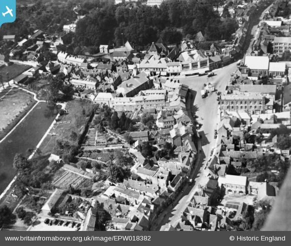
EPW018382 ENGLAND (1927). High Street and The Broadway, Chesham, 1927. This image has been produced from a copy-negative.
© Copyright OpenStreetMap contributors and licensed by the OpenStreetMap Foundation. 2025. Cartography is licensed as CC BY-SA.
Nearby Images (8)
Details
| Title | [EPW018382] High Street and The Broadway, Chesham, 1927. This image has been produced from a copy-negative. |
| Reference | EPW018382 |
| Date | June-1927 |
| Link | |
| Place name | CHESHAM |
| Parish | CHESHAM |
| District | |
| Country | ENGLAND |
| Easting / Northing | 495942, 201691 |
| Longitude / Latitude | -0.61139270804004, 51.705285891294 |
| National Grid Reference | SP959017 |
Pins

totoro |
Thursday 27th of November 2014 09:32:15 PM | |

totoro |
Thursday 27th of November 2014 09:30:54 PM |


![[EPW018382] High Street and The Broadway, Chesham, 1927. This image has been produced from a copy-negative.](http://britainfromabove.org.uk/sites/all/libraries/aerofilms-images/public/100x100/EPW/018/EPW018382.jpg)
![[EPW018387] Skottowe's Pond and the town centre, Chesham, 1927. This image has been produced from a copy-negative.](http://britainfromabove.org.uk/sites/all/libraries/aerofilms-images/public/100x100/EPW/018/EPW018387.jpg)
![[EPW018385] Broadway and the High Street, Chesham, 1927. This image has been produced from a copy-negative.](http://britainfromabove.org.uk/sites/all/libraries/aerofilms-images/public/100x100/EPW/018/EPW018385.jpg)
![[EPW018379] The Broadway, Chesham, 1927. This image has been produced from a copy-negative.](http://britainfromabove.org.uk/sites/all/libraries/aerofilms-images/public/100x100/EPW/018/EPW018379.jpg)
![[EPW018384] Blucher Street and The Broadway, Chesham, 1927. This image has been produced from a copy-negative.](http://britainfromabove.org.uk/sites/all/libraries/aerofilms-images/public/100x100/EPW/018/EPW018384.jpg)
![[EAW003135] The town, Chesham, from the south-east, 1946](http://britainfromabove.org.uk/sites/all/libraries/aerofilms-images/public/100x100/EAW/003/EAW003135.jpg)
![[EPW018381] St Mary's Church, Skottowe's Pond and environs, Chesham, 1927. This image has been produced from a copy-negative.](http://britainfromabove.org.uk/sites/all/libraries/aerofilms-images/public/100x100/EPW/018/EPW018381.jpg)
![[EPW021326] High Street and the town, Chesham, 1928](http://britainfromabove.org.uk/sites/all/libraries/aerofilms-images/public/100x100/EPW/021/EPW021326.jpg)