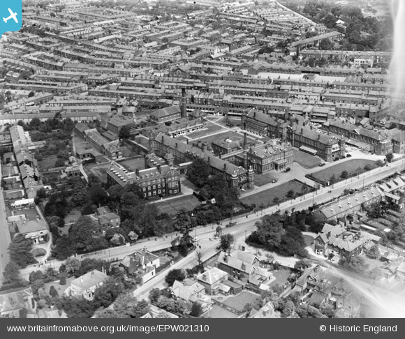
EPW021310 ENGLAND (1928). The Norfolk and Norwich Hospital and environs, Norwich, 1928
© Copyright OpenStreetMap contributors and licensed by the OpenStreetMap Foundation. 2026. Cartography is licensed as CC BY-SA.
Details
| Title | [EPW021310] The Norfolk and Norwich Hospital and environs, Norwich, 1928 |
| Reference | EPW021310 |
| Date | 26-May-1928 |
| Link | |
| Place name | NORWICH |
| Parish | |
| District | |
| Country | ENGLAND |
| Easting / Northing | 622555, 307797 |
| Longitude / Latitude | 1.2883949511153, 52.62188772448 |
| National Grid Reference | TG226078 |
Pins

fraser |
Monday 16th of December 2019 07:26:16 PM | |

fraser |
Monday 16th of December 2019 07:18:55 PM | |

Chris Lambert |
Saturday 25th of April 2015 07:15:57 PM | |

Chris Lambert |
Sunday 12th of April 2015 04:39:51 PM | |

Class31 |
Sunday 2nd of September 2012 06:18:16 PM | |

Class31 |
Sunday 2nd of September 2012 06:17:57 PM |


![[EPW021310] The Norfolk and Norwich Hospital and environs, Norwich, 1928](http://britainfromabove.org.uk/sites/all/libraries/aerofilms-images/public/100x100/EPW/021/EPW021310.jpg)
![[EPW021308] The Norfolk and Norwich Hospital, Norwich, 1928](http://britainfromabove.org.uk/sites/all/libraries/aerofilms-images/public/100x100/EPW/021/EPW021308.jpg)
![[EPW021311] The Norfolk and Norwich Hospital, Norwich, 1928](http://britainfromabove.org.uk/sites/all/libraries/aerofilms-images/public/100x100/EPW/021/EPW021311.jpg)
![[EPW021309] The Norfolk and Norwich Hospital, Norwich, 1928](http://britainfromabove.org.uk/sites/all/libraries/aerofilms-images/public/100x100/EPW/021/EPW021309.jpg)
