
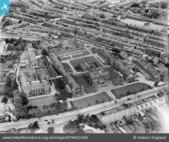
EPW021308 ENGLAND (1928). The Norfolk and Norwich Hospital, Norwich, 1928
© Copyright OpenStreetMap contributors and licensed by the OpenStreetMap Foundation. 2026. Cartography is licensed as CC BY-SA.
Nearby Images (4)
EPW021308

EPW021311

EPW021309

EPW021310

Details
| Title | [EPW021308] The Norfolk and Norwich Hospital, Norwich, 1928 |
| Reference | EPW021308 |
| Date | 26-May-1928 |
| Link | |
| Place name | NORWICH |
| Parish | |
| District | |
| Country | ENGLAND |
| Easting / Northing | 622564, 307836 |
| Longitude / Latitude | 1.2885539581026, 52.622234098947 |
| National Grid Reference | TG226078 |
Pins

User Comment Contributions
In the top right hand corner is Bignold school, still a thriving primary school. The Hospital has now moved out of the city center and the buildings have been converted into a large amount of flats. The tennis court is in front of the former nurses home |

Worms |
Wednesday 27th of June 2012 06:45:50 PM |