
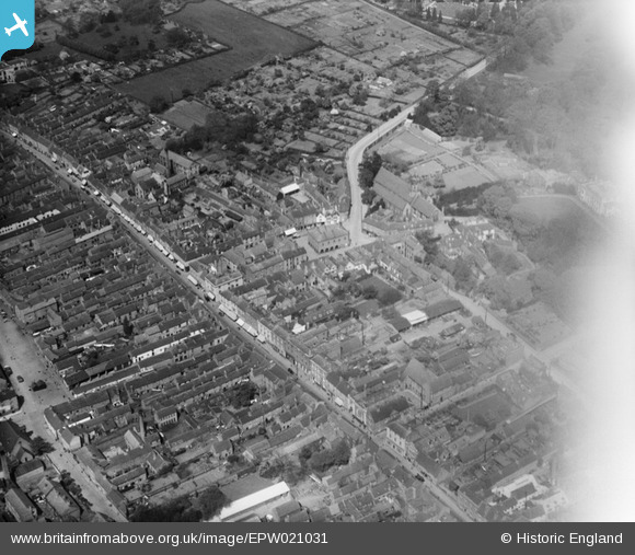
EPW021031 ENGLAND (1928). Long Street and the Market Hall, Atherstone, 1928
© Copyright OpenStreetMap contributors and licensed by the OpenStreetMap Foundation. 2026. Cartography is licensed as CC BY-SA.
Nearby Images (15)
EPW021031

EPW021027

EPW019729

EPW051903

EPW051907

EPW051901

EPW051902

EPW051904

EPW051899

EPW051900

EPW051908

EPW051905

EPW051906

EPW051898

EPW019726

Details
| Title | [EPW021031] Long Street and the Market Hall, Atherstone, 1928 |
| Reference | EPW021031 |
| Date | April-1928 |
| Link | |
| Place name | ATHERSTONE |
| Parish | ATHERSTONE |
| District | |
| Country | ENGLAND |
| Easting / Northing | 430840, 297871 |
| Longitude / Latitude | -1.5448444655994, 52.577421114082 |
| National Grid Reference | SP308979 |
Pins
Be the first to add a comment to this image!