
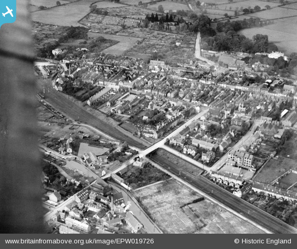
EPW019726 ENGLAND (1927). Coleshill Street West and the town, Atherstone, 1927
© Copyright OpenStreetMap contributors and licensed by the OpenStreetMap Foundation. 2026. Cartography is licensed as CC BY-SA.
Nearby Images (7)
EPW019726

EPW021027

EPW019729

EPW050405

EPW050409

EPW021031

EPW019728

Details
| Title | [EPW019726] Coleshill Street West and the town, Atherstone, 1927 |
| Reference | EPW019726 |
| Date | October-1927 |
| Link | |
| Place name | ATHERSTONE |
| Parish | ATHERSTONE |
| District | |
| Country | ENGLAND |
| Easting / Northing | 430693, 297658 |
| Longitude / Latitude | -1.5470336440045, 52.575514438882 |
| National Grid Reference | SP307977 |
