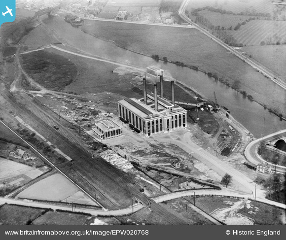
EPW020768 ENGLAND (1928). Ferrybridge Power Station, Ferrybridge, 1928
    © Copyright OpenStreetMap contributors and licensed by the OpenStreetMap Foundation. 2025. Cartography is licensed as CC BY-SA.
  
Nearby Images (5)
Details
| Title | [EPW020768] Ferrybridge Power Station, Ferrybridge, 1928 | 
| Reference | EPW020768 | 
| Date | 11-May-1928 | 
| Link | |
| Place name | FERRYBRIDGE | 
| Parish | |
| District | |
| Country | ENGLAND | 
| Easting / Northing | 448170, 424712 | 
| Longitude / Latitude | -1.2700122793032, 53.716371954779 | 
| National Grid Reference | SE482247 | 
Pins
|  Low Street | Class31 | Friday 28th of September 2012 11:22:17 PM | 
 
             
  ![[EPW020768] Ferrybridge Power Station, Ferrybridge, 1928](http://britainfromabove.org.uk/sites/all/libraries/aerofilms-images/public/100x100/EPW/020/EPW020768.jpg) 
  
                                          ![[EPW018208] The Ferrybridge A power station, Ferrybridge, 1927](http://britainfromabove.org.uk/sites/all/libraries/aerofilms-images/public/100x100/EPW/018/EPW018208.jpg) 
 ![[EPW020769] Ferrybridge Power Station and Ferry Bridge, Ferrybridge, 1928](http://britainfromabove.org.uk/sites/all/libraries/aerofilms-images/public/100x100/EPW/020/EPW020769.jpg) 
 ![[EPW015441] Ferrybridge Power Station under construction, Ferrybridge, 1926](http://britainfromabove.org.uk/sites/all/libraries/aerofilms-images/public/100x100/EPW/015/EPW015441.jpg) 
 ![[EPW018209] The Ferrybridge A power station, Ferrybridge, 1927](http://britainfromabove.org.uk/sites/all/libraries/aerofilms-images/public/100x100/EPW/018/EPW018209.jpg)