
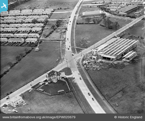
EPW020679 ENGLAND (1928). The Kingston Bypass and Burlington Road, West Barnes, 1928
© Copyright OpenStreetMap contributors and licensed by the OpenStreetMap Foundation. 2026. Cartography is licensed as CC BY-SA.
Nearby Images (12)
EPW020679

EAW035373

EAW035372

EAW035379

EAW035371

EAW035374

EAW035375

EAW035376

EAW035378

EAW035377

EAW035380

EPR000445

Details
| Title | [EPW020679] The Kingston Bypass and Burlington Road, West Barnes, 1928 |
| Reference | EPW020679 |
| Date | March-1928 |
| Link | |
| Place name | WEST BARNES |
| Parish | |
| District | |
| Country | ENGLAND |
| Easting / Northing | 522282, 168174 |
| Longitude / Latitude | -0.24199147783787, 51.398906966639 |
| National Grid Reference | TQ223682 |
