
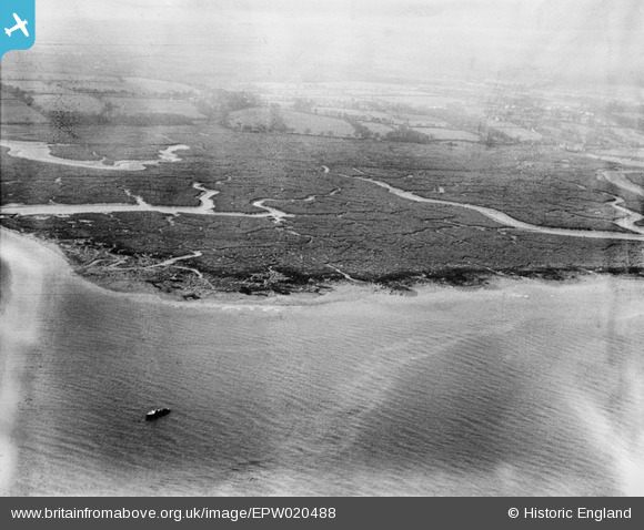
EPW020488 ENGLAND (1928). Southampton Water mud flats, Calshot, from the north-east, 1928
© Copyright OpenStreetMap contributors and licensed by the OpenStreetMap Foundation. 2026. Cartography is licensed as CC BY-SA.
Nearby Images (2)
EPW020488

EPW020511

Details
| Title | [EPW020488] Southampton Water mud flats, Calshot, from the north-east, 1928 |
| Reference | EPW020488 |
| Date | 16-March-1928 |
| Link | |
| Place name | CALSHOT |
| Parish | FAWLEY |
| District | |
| Country | ENGLAND |
| Easting / Northing | 448116, 103024 |
| Longitude / Latitude | -1.3167995615819, 50.824192875217 |
| National Grid Reference | SU481030 |
Pins

Graham Yaxley |
Wednesday 17th of December 2014 03:06:24 PM | |

Class31 |
Tuesday 7th of August 2012 08:20:11 PM |