
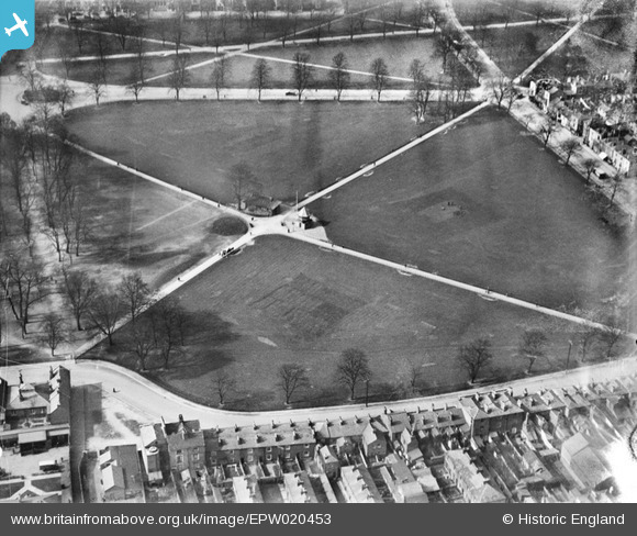
EPW020453 ENGLAND (1928). Hoglands Park, Southampton, 1928
© Copyright OpenStreetMap contributors and licensed by the OpenStreetMap Foundation. 2026. Cartography is licensed as CC BY-SA.
Nearby Images (5)
EPW020453

EPW009079

EPW020443

EPW013581

EPW009078

Details
| Title | [EPW020453] Hoglands Park, Southampton, 1928 |
| Reference | EPW020453 |
| Date | 16-March-1928 |
| Link | |
| Place name | SOUTHAMPTON |
| Parish | |
| District | |
| Country | ENGLAND |
| Easting / Northing | 442364, 111777 |
| Longitude / Latitude | -1.3974534586763, 50.90335811011 |
| National Grid Reference | SU424118 |
Pins

User Comment Contributions
View looking west. We have cricket pitches in three of the park quadrants. |

Class31 |
Monday 6th of August 2012 10:15:32 AM |