
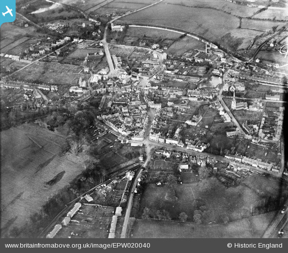
EPW020040 ENGLAND (1927). The Market Place, Brook Square and the town centre, Rugeley, 1927
© Copyright OpenStreetMap contributors and licensed by the OpenStreetMap Foundation. 2026. Cartography is licensed as CC BY-SA.
Nearby Images (3)
EPW020040

EPW020041

EPW020043

Details
| Title | [EPW020040] The Market Place, Brook Square and the town centre, Rugeley, 1927 |
| Reference | EPW020040 |
| Date | October-1927 |
| Link | |
| Place name | RUGELEY |
| Parish | RUGELEY |
| District | |
| Country | ENGLAND |
| Easting / Northing | 404403, 317941 |
| Longitude / Latitude | -1.9347485149711, 52.758721602307 |
| National Grid Reference | SK044179 |
Pins

flodo49 |
Saturday 25th of April 2015 05:48:56 PM | |
|
flodo49 |
Saturday 25th of April 2015 05:48:07 PM | |
|
flodo49 |
Saturday 25th of April 2015 05:47:28 PM | |
|
flodo49 |
Saturday 25th of April 2015 05:46:46 PM | |
|
flodo49 |
Saturday 25th of April 2015 05:46:10 PM | |
|
flodo49 |
Saturday 25th of April 2015 05:45:23 PM | |
|
flodo49 |
Saturday 25th of April 2015 05:42:52 PM | |
|
flodo49 |
Saturday 25th of April 2015 05:41:01 PM | |
|
flodo49 |
Saturday 25th of April 2015 05:40:06 PM | |
|
flodo49 |
Saturday 25th of April 2015 05:38:51 PM |