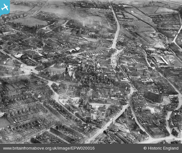
EPW020016 ENGLAND (1927). The Town Centre, Newcastle-Under-Lyme, 1927
© Copyright OpenStreetMap contributors and licensed by the OpenStreetMap Foundation. 2026. Cartography is licensed as CC BY-SA.
Nearby Images (7)
Details
| Title | [EPW020016] The Town Centre, Newcastle-Under-Lyme, 1927 |
| Reference | EPW020016 |
| Date | October-1927 |
| Link | |
| Place name | NEWCASTLE-UNDER-LYME |
| Parish | |
| District | |
| Country | ENGLAND |
| Easting / Northing | 384908, 346061 |
| Longitude / Latitude | -2.2249640189009, 53.01133660168 |
| National Grid Reference | SJ849461 |
Pins

David Angus Lawrence |
Monday 27th of May 2019 06:52:42 PM | |

Spraggy |
Tuesday 26th of June 2012 02:00:30 PM | |

Spraggy |
Tuesday 26th of June 2012 01:59:53 PM | |

Spraggy |
Tuesday 26th of June 2012 01:59:28 PM | |

Spraggy |
Tuesday 26th of June 2012 01:58:54 PM |


![[EPW020016] The Town Centre, Newcastle-Under-Lyme, 1927](http://britainfromabove.org.uk/sites/all/libraries/aerofilms-images/public/100x100/EPW/020/EPW020016.jpg)
![[EPW020015] Nelson Place and environs, Newcastle-under-Lyme, 1927](http://britainfromabove.org.uk/sites/all/libraries/aerofilms-images/public/100x100/EPW/020/EPW020015.jpg)
![[EPW042746] The town centre, Newcastle-under-Lyme, 1933](http://britainfromabove.org.uk/sites/all/libraries/aerofilms-images/public/100x100/EPW/042/EPW042746.jpg)
![[EPW028090] The town centre, Newcastle-under-Lyme, 1929](http://britainfromabove.org.uk/sites/all/libraries/aerofilms-images/public/100x100/EPW/028/EPW028090.jpg)
![[EPW042745] The town centre, Newcastle-under-Lyme, 1933](http://britainfromabove.org.uk/sites/all/libraries/aerofilms-images/public/100x100/EPW/042/EPW042745.jpg)
![[EPW020010] Penkhull Street and environs, Newcastle-under-Lyme, 1927](http://britainfromabove.org.uk/sites/all/libraries/aerofilms-images/public/100x100/EPW/020/EPW020010.jpg)
![[EPW020017] Nelson Place and environs, Newcastle-Under-Lyme, 1927](http://britainfromabove.org.uk/sites/all/libraries/aerofilms-images/public/100x100/EPW/020/EPW020017.jpg)