
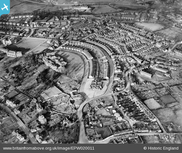
EPW020011 ENGLAND (1927). Greatbach Avenue and the North Staffordshire Blind and Deaf School, Hartshill, 1927
© Copyright OpenStreetMap contributors and licensed by the OpenStreetMap Foundation. 2026. Cartography is licensed as CC BY-SA.
Nearby Images (2)
EPW020011

EPW020068

Details
| Title | [EPW020011] Greatbach Avenue and the North Staffordshire Blind and Deaf School, Hartshill, 1927 |
| Reference | EPW020011 |
| Date | October-1927 |
| Link | |
| Place name | HARTSHILL |
| Parish | |
| District | |
| Country | ENGLAND |
| Easting / Northing | 386991, 345164 |
| Longitude / Latitude | -2.1938785253521, 53.003327110078 |
| National Grid Reference | SJ870452 |
Pins

Katie W |
Saturday 2nd of January 2021 09:35:10 AM | |
|
Katie W |
Saturday 2nd of January 2021 09:33:04 AM | |
|
Katie W |
Saturday 2nd of January 2021 09:32:10 AM | |
|
Katie W |
Saturday 2nd of January 2021 09:31:41 AM | |
|
Kerpow1 |
Friday 25th of September 2015 02:36:53 PM | |
|
reg edwards |
Saturday 30th of June 2012 08:39:31 AM | |
|
Iain |
Tuesday 26th of June 2012 03:45:50 PM | |
|
Iain |
Tuesday 26th of June 2012 03:44:27 PM | |
|
leeguv |
Monday 25th of June 2012 07:25:40 PM | |
|
leeguv |
Monday 25th of June 2012 07:20:55 PM | |
Richmond Street was originally two streets, the original higher part was named Richmond Street when it was first built around the 1870s? The lower part joining Honeywall was called Jubilee Road until the 1950s street renaming, when it all became Richmond Street. |
Muso |
Friday 26th of April 2013 09:35:58 PM |
User Comment Contributions
This is actually Penkhull not Hartshill. Penkhull was a much older area and had the Manorial court held there. |
amm |
Friday 29th of June 2012 08:36:25 PM |