
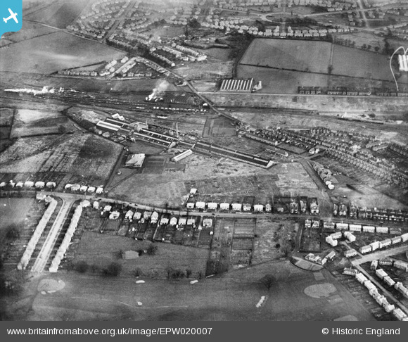
EPW020007 ENGLAND (1927). The Goodyear Tyre and Rubber Company, Bushbury, 1927
© Copyright OpenStreetMap contributors and licensed by the OpenStreetMap Foundation. 2026. Cartography is licensed as CC BY-SA.
Nearby Images (48)
EPW020007

EAW000791

EPW054858

EPW020002

EPW020004

EPW020005

EPW054852

EPW045791

EPW028629

EAW000789

EPW020003

EPW020008

EPW028634

EPW028636

EPW054857

EAW000790

EPW045788

EPW028637

EAW000788

EPW028647

EPW045786

EPW024556

EPW020001

EPW020006

EPW022892

EPW028638

EPW024552

EPW028630

EPW028631

EPW020000

EPW024554

EPW045790

EPW045787

EPW054856

EPW021011

EAW000787

EPW024555

EPW022889

EPW028635

EPW045785

EPW022895

EPW019999

EPW022890

EPW028633

EPW054855

EPW021010

EPW017845

EPW017850

Details
| Title | [EPW020007] The Goodyear Tyre and Rubber Company, Bushbury, 1927 |
| Reference | EPW020007 |
| Date | October-1927 |
| Link | |
| Place name | BUSHBURY |
| Parish | |
| District | |
| Country | ENGLAND |
| Easting / Northing | 391403, 301310 |
| Longitude / Latitude | -2.1269711253683, 52.609147215999 |
| National Grid Reference | SJ914013 |
Pins
Be the first to add a comment to this image!