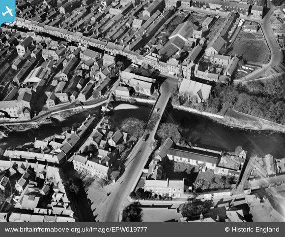
EPW019777 ENGLAND (1927). The New and Old Bridges, Morpeth, 1927
© Copyright OpenStreetMap contributors and licensed by the OpenStreetMap Foundation. 2026. Cartography is licensed as CC BY-SA.
Nearby Images (5)
Details
| Title | [EPW019777] The New and Old Bridges, Morpeth, 1927 |
| Reference | EPW019777 |
| Date | 18-October-1927 |
| Link | |
| Place name | MORPETH |
| Parish | MORPETH |
| District | |
| Country | ENGLAND |
| Easting / Northing | 420060, 585858 |
| Longitude / Latitude | -1.6850713656115, 55.16657702457 |
| National Grid Reference | NZ201859 |


![[EPW019777] The New and Old Bridges, Morpeth, 1927](http://britainfromabove.org.uk/sites/all/libraries/aerofilms-images/public/100x100/EPW/019/EPW019777.jpg)
![[EPW019780] Castle Square and the New Bridge, Morpeth, 1927](http://britainfromabove.org.uk/sites/all/libraries/aerofilms-images/public/100x100/EPW/019/EPW019780.jpg)
![[EAW014539] Court House, Morpeth Castle and Carlisle Park, Morpeth, 1948](http://britainfromabove.org.uk/sites/all/libraries/aerofilms-images/public/100x100/EAW/014/EAW014539.jpg)
![[EAW014540] Court House, Morpeth Castle and Haw Hill, Morpeth, 1948](http://britainfromabove.org.uk/sites/all/libraries/aerofilms-images/public/100x100/EAW/014/EAW014540.jpg)
![[EPW019778] The Market Place, Morpeth, 1927](http://britainfromabove.org.uk/sites/all/libraries/aerofilms-images/public/100x100/EPW/019/EPW019778.jpg)
