
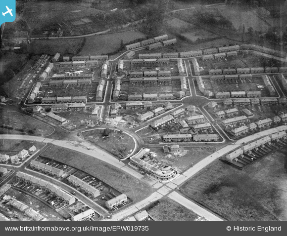
EPW019735 ENGLAND (1927). Cramper's Field and environs, Coventry, 1927
© Copyright OpenStreetMap contributors and licensed by the OpenStreetMap Foundation. 2026. Cartography is licensed as CC BY-SA.
Nearby Images (2)
EPW019735

EPW035779

Details
| Title | [EPW019735] Cramper's Field and environs, Coventry, 1927 |
| Reference | EPW019735 |
| Date | October-1927 |
| Link | |
| Place name | COVENTRY |
| Parish | |
| District | |
| Country | ENGLAND |
| Easting / Northing | 432463, 280033 |
| Longitude / Latitude | -1.5226321921419, 52.416951095366 |
| National Grid Reference | SP325800 |
Pins

Coventry kid |
Saturday 23rd of August 2014 03:50:01 PM | |

offshoredaze |
Tuesday 11th of February 2014 06:05:41 PM | |
|
offshoredaze |
Tuesday 11th of February 2014 06:04:56 PM | |
|
offshoredaze |
Tuesday 11th of February 2014 06:04:14 PM |
User Comment Contributions
my dad grew up in tomson avenue,during the April 1941 blitz on coventry radford was a major target.My dad's house was hit by incendiary bomb's.first the front garden then the back garden and then a direct hit.they moved to bridgeman road.i have the old photo's of the house of my gran standing by the ruins, the priest from St Osburgs came to see my nan and said if she had been a better catholic it would not have happened then ironically in the november blitz the priests house was hit.I cannot repeat what my nan said about that |
derek |
Tuesday 10th of March 2015 09:30:38 AM |