
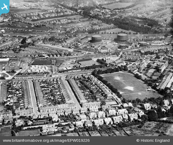
EPW019226 ENGLAND (1927). Lyndhurst Road and environs, Luton, 1927
© Copyright OpenStreetMap contributors and licensed by the OpenStreetMap Foundation. 2026. Cartography is licensed as CC BY-SA.
Nearby Images (9)
EPW019226

EPW026485

EPW037378

EPW037377

EPW019218

EPW005364

EPW005365

EPW005366

EPW037379

Details
| Title | [EPW019226] Lyndhurst Road and environs, Luton, 1927 |
| Reference | EPW019226 |
| Date | August-1927 |
| Link | |
| Place name | LUTON |
| Parish | |
| District | |
| Country | ENGLAND |
| Easting / Northing | 508373, 221488 |
| Longitude / Latitude | -0.42535590740581, 51.880971040337 |
| National Grid Reference | TL084215 |
Pins

brian |
Sunday 19th of October 2014 01:54:59 AM | |
|
brian |
Sunday 19th of October 2014 01:52:09 AM | |

Dylan Moore |
Saturday 27th of October 2012 03:21:46 PM | |
|
Dylan Moore |
Friday 26th of October 2012 06:05:25 PM | |
|
Dylan Moore |
Friday 26th of October 2012 06:03:38 PM | |
|
Dylan Moore |
Friday 26th of October 2012 06:02:41 PM | |
|
Dylan Moore |
Friday 26th of October 2012 05:58:59 PM | |
|
Dylan Moore |
Friday 26th of October 2012 05:57:52 PM | |
|
Dylan Moore |
Friday 26th of October 2012 05:57:13 PM | |
|
Dylan Moore |
Friday 26th of October 2012 05:55:50 PM | |
|
Dylan Moore |
Friday 26th of October 2012 05:54:09 PM | |
|
Dylan Moore |
Friday 26th of October 2012 05:53:34 PM | |
|
Dylan Moore |
Friday 26th of October 2012 05:51:38 PM | |
|
Dylan Moore |
Friday 26th of October 2012 05:51:01 PM |