
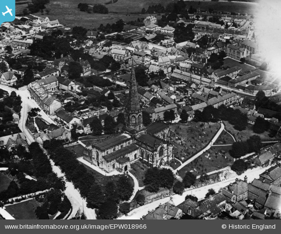
EPW018966 ENGLAND (1927). All Saints' Church, Bakewell, 1927. This image has been produced from a print affected by flare.
© Copyright OpenStreetMap contributors and licensed by the OpenStreetMap Foundation. 2026. Cartography is licensed as CC BY-SA.
Nearby Images (8)
EPW018966

EPW018965

EPW018963

EAW016079

EPW018962

EAW016081

EAW016082

EPW018967

Details
| Title | [EPW018966] All Saints' Church, Bakewell, 1927. This image has been produced from a print affected by flare. |
| Reference | EPW018966 |
| Date | July-1927 |
| Link | |
| Place name | BAKEWELL |
| Parish | BAKEWELL |
| District | |
| Country | ENGLAND |
| Easting / Northing | 421564, 368477 |
| Longitude / Latitude | -1.6770583303638, 53.212632726561 |
| National Grid Reference | SK216685 |
Pins
Be the first to add a comment to this image!