
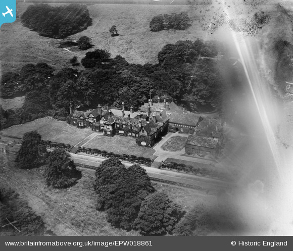
EPW018861 ENGLAND (1927). Smithill's Hall, Smithills Country Park, 1927
© Copyright OpenStreetMap contributors and licensed by the OpenStreetMap Foundation. 2026. Cartography is licensed as CC BY-SA.
Nearby Images (4)
EPW018861

EPW018862

EPW018664

EPW018663

Details
| Title | [EPW018861] Smithill's Hall, Smithills Country Park, 1927 |
| Reference | EPW018861 |
| Date | July-1927 |
| Link | |
| Place name | SMITHILLS COUNTRY PARK |
| Parish | |
| District | |
| Country | ENGLAND |
| Easting / Northing | 369942, 411870 |
| Longitude / Latitude | -2.4542805999062, 53.602293781972 |
| National Grid Reference | SD699119 |
Pins
Be the first to add a comment to this image!