
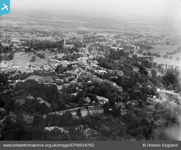
EPW018763 ENGLAND (1927). St Mary's Church and the town centre, Harrow-on-the-Hill, from the south-west, 1927
© Copyright OpenStreetMap contributors and licensed by the OpenStreetMap Foundation. 2026. Cartography is licensed as CC BY-SA.
Nearby Images (2)
EPW018763

EAW024233

Details
| Title | [EPW018763] St Mary's Church and the town centre, Harrow-on-the-Hill, from the south-west, 1927 |
| Reference | EPW018763 |
| Date | July-1927 |
| Link | |
| Place name | HARROW-ON-THE-HILL |
| Parish | |
| District | |
| Country | ENGLAND |
| Easting / Northing | 515104, 186924 |
| Longitude / Latitude | -0.33902605291085, 51.568948479748 |
| National Grid Reference | TQ151869 |
Pins

Tim |
Saturday 28th of December 2013 03:06:40 AM |