
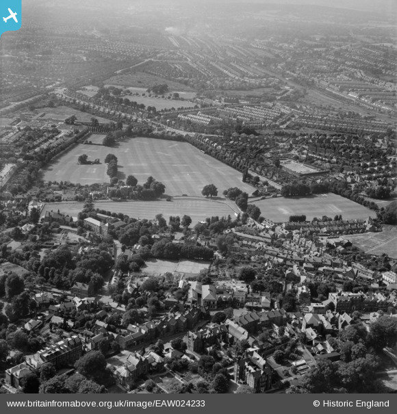
EAW024233 ENGLAND (1949). Harrow School Cricket Grounds, Harrow on the Hill, from the south-east, 1949
© Copyright OpenStreetMap contributors and licensed by the OpenStreetMap Foundation. 2026. Cartography is licensed as CC BY-SA.
Nearby Images (6)
EAW024233

EPW018763

EPW053679

EPW000469

EPW000468

EPW000467

Details
| Title | [EAW024233] Harrow School Cricket Grounds, Harrow on the Hill, from the south-east, 1949 |
| Reference | EAW024233 |
| Date | 27-June-1949 |
| Link | |
| Place name | HARROW ON THE HILL |
| Parish | |
| District | |
| Country | ENGLAND |
| Easting / Northing | 515051, 187081 |
| Longitude / Latitude | -0.33973908991145, 51.570370512389 |
| National Grid Reference | TQ151871 |
Pins

FG |
Monday 22nd of February 2021 03:12:43 PM | |
|
The Laird |
Sunday 12th of January 2020 08:32:29 PM | |
|
The Laird |
Sunday 12th of January 2020 08:15:32 PM | |
|
Sweet Pete |
Friday 1st of January 2016 04:45:41 PM | |
|
Sweet Pete |
Friday 1st of January 2016 04:42:02 PM | |
|
The Laird |
Wednesday 26th of August 2015 12:08:50 PM | |
|
The Laird |
Wednesday 26th of August 2015 11:56:33 AM | |
|
The Laird |
Wednesday 26th of August 2015 11:55:17 AM | |
|
czyrko |
Sunday 27th of April 2014 07:51:43 AM | |
|
JamesMac |
Friday 24th of January 2014 07:37:44 PM | |
|
Gez |
Thursday 9th of January 2014 09:27:55 PM | |

Tim |
Saturday 28th of December 2013 02:49:23 AM | |
|
Tim |
Saturday 28th of December 2013 02:46:28 AM | |
|
Tim |
Saturday 28th of December 2013 02:45:19 AM | |
|
Tim |
Saturday 28th of December 2013 02:44:02 AM |