
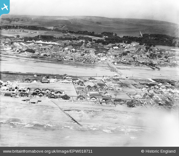
EPW018711 ENGLAND (1927). Shoreham Beach and the drawbridge, Shoreham-by-Sea, 1927
© Copyright OpenStreetMap contributors and licensed by the OpenStreetMap Foundation. 2026. Cartography is licensed as CC BY-SA.
Nearby Images (4)
EPW018711

EPW018713

EPW011518

EAW022247

Details
| Title | [EPW018711] Shoreham Beach and the drawbridge, Shoreham-by-Sea, 1927 |
| Reference | EPW018711 |
| Date | July-1927 |
| Link | |
| Place name | SHOREHAM-BY-SEA |
| Parish | |
| District | |
| Country | ENGLAND |
| Easting / Northing | 521569, 104769 |
| Longitude / Latitude | -0.27361250236446, 50.829114966277 |
| National Grid Reference | TQ216048 |
Pins

Matt |
Monday 29th of April 2024 09:52:46 AM | |

Alan McFaden |
Monday 2nd of December 2013 08:03:33 PM | |
|
Alan McFaden |
Friday 4th of October 2013 10:09:27 AM | |
|
Alan McFaden |
Friday 4th of October 2013 10:08:44 AM | |
|
Alan McFaden |
Friday 4th of October 2013 10:08:03 AM | |
|
Alan McFaden |
Friday 4th of October 2013 10:07:20 AM | |
|
Alan McFaden |
Friday 4th of October 2013 10:06:01 AM |


