
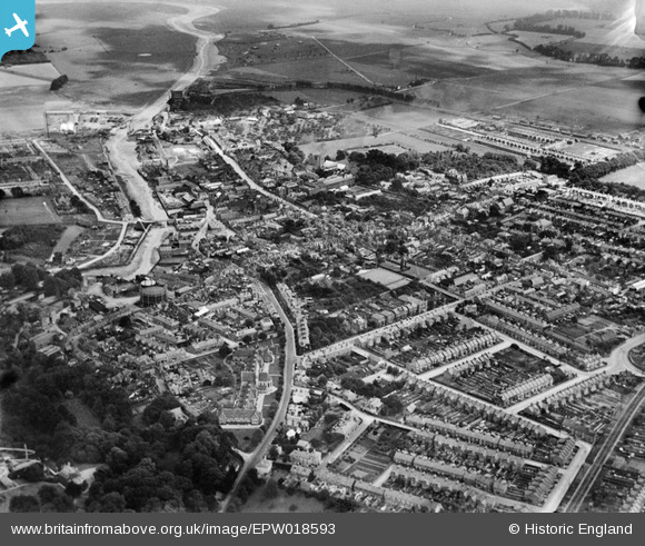
EPW018593 ENGLAND (1927). South Road and the town, Faversham, from the south-west, 1927
© Copyright OpenStreetMap contributors and licensed by the OpenStreetMap Foundation. 2026. Cartography is licensed as CC BY-SA.
Nearby Images (9)
EPW018593

EPW018635

EPW009152

EAW028817

EPW018597

EPW018634

EAW028818

EPW018598

EPW018595

Details
| Title | [EPW018593] South Road and the town, Faversham, from the south-west, 1927 |
| Reference | EPW018593 |
| Date | 22-June-1927 |
| Link | |
| Place name | FAVERSHAM |
| Parish | FAVERSHAM |
| District | |
| Country | ENGLAND |
| Easting / Northing | 601241, 161259 |
| Longitude / Latitude | 0.88801793508354, 51.314292744742 |
| National Grid Reference | TR012613 |
Pins

Kizle7 |
Friday 30th of September 2022 01:05:45 AM | |
|
Andyreno205 |
Tuesday 18th of January 2022 02:21:32 PM | |
|
Bean |
Friday 14th of February 2014 09:55:42 PM | |
|
JimP |
Wednesday 6th of November 2013 05:44:42 PM | |
|
Ian |
Monday 22nd of October 2012 08:08:25 AM | |
|
Ian |
Monday 22nd of October 2012 08:04:00 AM | |
|
Ian |
Monday 22nd of October 2012 08:00:05 AM | |
|
Ian |
Monday 22nd of October 2012 07:56:54 AM | |
|
rorykehoe |
Monday 6th of August 2012 06:21:13 PM | |
|
rorykehoe |
Monday 6th of August 2012 06:20:22 PM |