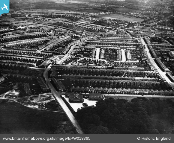
EPW018365 ENGLAND (1927). Abbey Road and environs, Bearwood, 1927. This image has been produced from a print.
© Copyright OpenStreetMap contributors and licensed by the OpenStreetMap Foundation. 2025. Cartography is licensed as CC BY-SA.
Details
| Title | [EPW018365] Abbey Road and environs, Bearwood, 1927. This image has been produced from a print. |
| Reference | EPW018365 |
| Date | 10-June-1927 |
| Link | |
| Place name | BEARWOOD |
| Parish | |
| District | |
| Country | ENGLAND |
| Easting / Northing | 401659, 286518 |
| Longitude / Latitude | -1.9755717437054, 52.476219167094 |
| National Grid Reference | SP017865 |
Pins
 Margaret |
Thursday 22nd of August 2024 09:20:23 AM | |
 Margaret |
Thursday 22nd of August 2024 09:19:44 AM | |
 AdamStewart |
Tuesday 3rd of January 2023 06:04:43 PM | |
 LadyJai |
Monday 9th of November 2020 04:42:45 PM | |
 Kate Green |
Wednesday 12th of November 2014 12:53:50 PM | |
 Kate Green |
Wednesday 12th of November 2014 12:53:15 PM |


![[EPW018365] Abbey Road and environs, Bearwood, 1927. This image has been produced from a print.](http://britainfromabove.org.uk/sites/all/libraries/aerofilms-images/public/100x100/EPW/018/EPW018365.jpg)
![[EPW018361] Upper St Mary's Road, Bearwood, 1927. This image has been produced from a print.](http://britainfromabove.org.uk/sites/all/libraries/aerofilms-images/public/100x100/EPW/018/EPW018361.jpg)
