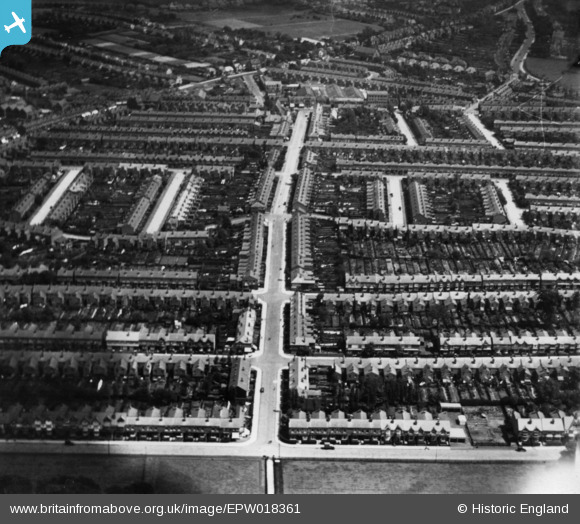
EPW018361 ENGLAND (1927). Upper St Mary's Road, Bearwood, 1927. This image has been produced from a print.
© Copyright OpenStreetMap contributors and licensed by the OpenStreetMap Foundation. 2025. Cartography is licensed as CC BY-SA.
Details
| Title | [EPW018361] Upper St Mary's Road, Bearwood, 1927. This image has been produced from a print. |
| Reference | EPW018361 |
| Date | 10-June-1927 |
| Link | |
| Place name | BEARWOOD |
| Parish | |
| District | |
| Country | ENGLAND |
| Easting / Northing | 401754, 286317 |
| Longitude / Latitude | -1.9741739565943, 52.474411676215 |
| National Grid Reference | SP018863 |
Pins
 LadyJai |
Monday 9th of November 2020 04:36:59 PM |


![[EPW018361] Upper St Mary's Road, Bearwood, 1927. This image has been produced from a print.](http://britainfromabove.org.uk/sites/all/libraries/aerofilms-images/public/100x100/EPW/018/EPW018361.jpg)
![[EPW018365] Abbey Road and environs, Bearwood, 1927. This image has been produced from a print.](http://britainfromabove.org.uk/sites/all/libraries/aerofilms-images/public/100x100/EPW/018/EPW018365.jpg)