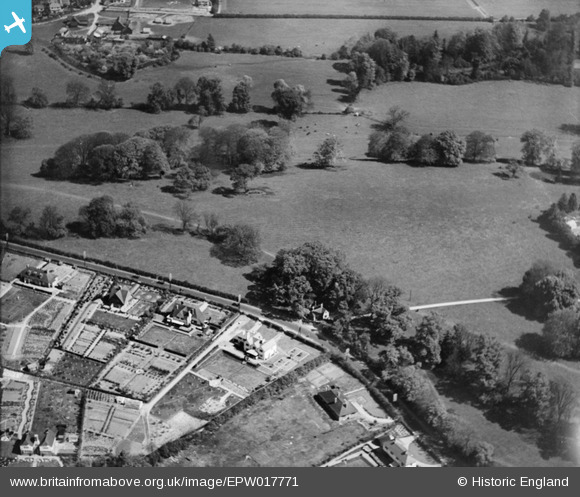
EPW017771 ENGLAND (1927). The Chorleywood Road Lodge for Rickmansworth Park, Rickmansworth, 1927
© Copyright OpenStreetMap contributors and licensed by the OpenStreetMap Foundation. 2026. Cartography is licensed as CC BY-SA.
Nearby Images (8)
Details
| Title | [EPW017771] The Chorleywood Road Lodge for Rickmansworth Park, Rickmansworth, 1927 |
| Reference | EPW017771 |
| Date | April-1927 |
| Link | |
| Place name | RICKMANSWORTH |
| Parish | |
| District | |
| Country | ENGLAND |
| Easting / Northing | 505510, 195598 |
| Longitude / Latitude | -0.47480312158638, 51.648797759794 |
| National Grid Reference | TQ055956 |
Pins

Mike |
Friday 27th of July 2012 01:25:29 PM |


![[EPW017771] The Chorleywood Road Lodge for Rickmansworth Park, Rickmansworth, 1927](http://britainfromabove.org.uk/sites/all/libraries/aerofilms-images/public/100x100/EPW/017/EPW017771.jpg)
![[EAW022716] The Royal Masonic School for Girls, Rickmansworth, from the north-west, 1949. This image has been produced from a print marked by Aerofilms Ltd for photo editing.](http://britainfromabove.org.uk/sites/all/libraries/aerofilms-images/public/100x100/EAW/022/EAW022716.jpg)
![[EAW022714] The Royal Masonic School for Girls and environs, Rickmansworth, from the north-west, 1949. This image has been produced from a print marked by Aerofilms Ltd for photo editing.](http://britainfromabove.org.uk/sites/all/libraries/aerofilms-images/public/100x100/EAW/022/EAW022714.jpg)
![[EAW022711] The Royal Masonic School for Girls and environs, Rickmansworth, from the north, 1949. This image has been produced from a print marked by Aerofilms Ltd for photo editing.](http://britainfromabove.org.uk/sites/all/libraries/aerofilms-images/public/100x100/EAW/022/EAW022711.jpg)
![[EPW044253] The Royal Masonic School for Girls, Rickmansworth, 1934](http://britainfromabove.org.uk/sites/all/libraries/aerofilms-images/public/100x100/EPW/044/EPW044253.jpg)
![[EAW022713] The Royal Masonic School for Girls, Rickmansworth, 1949. This image has been produced from a print.](http://britainfromabove.org.uk/sites/all/libraries/aerofilms-images/public/100x100/EAW/022/EAW022713.jpg)
![[EAW022715] The Royal Masonic School for Girls, Rickmansworth, 1949. This image has been produced from a print marked by Aerofilms Ltd for photo editing.](http://britainfromabove.org.uk/sites/all/libraries/aerofilms-images/public/100x100/EAW/022/EAW022715.jpg)
![[EPW044252] The Royal Masonic School for Girls, Rickmansworth, 1934](http://britainfromabove.org.uk/sites/all/libraries/aerofilms-images/public/100x100/EPW/044/EPW044252.jpg)