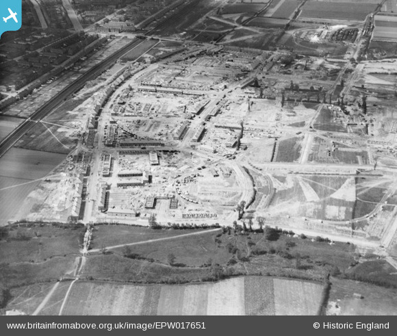
EPW017651 ENGLAND (1927). The Becontree Estate under construction, Becontree, 1927
© Copyright OpenStreetMap contributors and licensed by the OpenStreetMap Foundation. 2025. Cartography is licensed as CC BY-SA.
Details
| Title | [EPW017651] The Becontree Estate under construction, Becontree, 1927 |
| Reference | EPW017651 |
| Date | May-1927 |
| Link | |
| Place name | BECONTREE |
| Parish | |
| District | |
| Country | ENGLAND |
| Easting / Northing | 549562, 185094 |
| Longitude / Latitude | 0.1570956959175, 51.544416710166 |
| National Grid Reference | TQ496851 |
Pins

Ken Stanton |
Sunday 9th of May 2021 05:10:34 PM | |

Ken Stanton |
Sunday 9th of May 2021 05:09:39 PM | |

Ken Stanton |
Sunday 9th of May 2021 05:07:31 PM | |

Ken Stanton |
Sunday 9th of May 2021 05:06:03 PM | |

Ken Stanton |
Sunday 9th of May 2021 05:04:32 PM |


![[EPW017651] The Becontree Estate under construction, Becontree, 1927](http://britainfromabove.org.uk/sites/all/libraries/aerofilms-images/public/100x100/EPW/017/EPW017651.jpg)
![[EAW043580] Hunters Hall County Primary School looking towards Parsloes Park, Dagenham, from the north-east, 1952](http://britainfromabove.org.uk/sites/all/libraries/aerofilms-images/public/100x100/EAW/043/EAW043580.jpg)
![[EAW043582] Reede Road and environs, Dagenham, from the east, 1952](http://britainfromabove.org.uk/sites/all/libraries/aerofilms-images/public/100x100/EAW/043/EAW043582.jpg)