
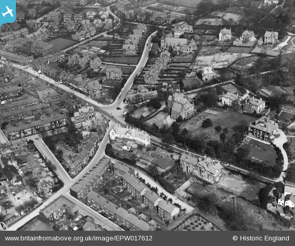
EPW017612 ENGLAND (1927). The junction of London Road and Congleton Road, Alderley Edge, 1927
© Copyright OpenStreetMap contributors and licensed by the OpenStreetMap Foundation. 2025. Cartography is licensed as CC BY-SA.
Nearby Images (3)
EPW017612

EPW017621

EPW017611

Details
| Title | [EPW017612] The junction of London Road and Congleton Road, Alderley Edge, 1927 |
| Reference | EPW017612 |
| Date | April-1927 |
| Link | |
| Place name | ALDERLEY EDGE |
| Parish | ALDERLEY EDGE |
| District | |
| Country | ENGLAND |
| Easting / Northing | 384354, 378103 |
| Longitude / Latitude | -2.2347882528598, 53.299375302836 |
| National Grid Reference | SJ844781 |
Pins

Class31 |
Wednesday 27th of March 2013 06:52:07 PM | |
|
Class31 |
Wednesday 27th of March 2013 06:51:38 PM | |
|
Class31 |
Wednesday 27th of March 2013 06:51:07 PM | |
|
Class31 |
Wednesday 27th of March 2013 06:50:28 PM | |

Mr |
Saturday 1st of September 2012 05:49:14 PM | |
|
Mr |
Saturday 1st of September 2012 05:47:54 PM | |
|
Mr |
Saturday 1st of September 2012 05:47:07 PM | |
|
Mr |
Saturday 1st of September 2012 05:46:17 PM | |
|
Mr |
Saturday 1st of September 2012 05:45:31 PM |