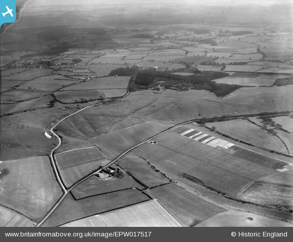
EPW017517 ENGLAND (1927). The Whipsnade Estate, Whipsnade, from north-west, 1927
© Copyright OpenStreetMap contributors and licensed by the OpenStreetMap Foundation. 2026. Cartography is licensed as CC BY-SA.
Nearby Images (11)
Details
| Title | [EPW017517] The Whipsnade Estate, Whipsnade, from north-west, 1927 |
| Reference | EPW017517 |
| Date | March-1927 |
| Link | |
| Place name | WHIPSNADE |
| Parish | WHIPSNADE |
| District | |
| Country | ENGLAND |
| Easting / Northing | 499690, 218240 |
| Longitude / Latitude | -0.55241100048085, 51.853394912271 |
| National Grid Reference | SP997182 |


![[EPW017517] The Whipsnade Estate, Whipsnade, from north-west, 1927](http://britainfromabove.org.uk/sites/all/libraries/aerofilms-images/public/100x100/EPW/017/EPW017517.jpg)
![[EPW017499] The Whipsnade Estate, Whipsnade, from the north-west, 1927](http://britainfromabove.org.uk/sites/all/libraries/aerofilms-images/public/100x100/EPW/017/EPW017499.jpg)
![[EPW017504] The Whipsnade Estate, Whipsnade, from the north-west, 1927](http://britainfromabove.org.uk/sites/all/libraries/aerofilms-images/public/100x100/EPW/017/EPW017504.jpg)
![[EPW035110] Whipsnade Park Zoo and surrounding countryside, Whipsnade, 1931](http://britainfromabove.org.uk/sites/all/libraries/aerofilms-images/public/100x100/EPW/035/EPW035110.jpg)
![[EPW017501] The Whipsnade Estate, Whipsnade, 1927](http://britainfromabove.org.uk/sites/all/libraries/aerofilms-images/public/100x100/EPW/017/EPW017501.jpg)
![[EPW017507] The Whipsnade Estate, Whipsnade, 1927](http://britainfromabove.org.uk/sites/all/libraries/aerofilms-images/public/100x100/EPW/017/EPW017507.jpg)
![[EPW017500] The Whipsnade Estate, Whipsnade, from the north-west, 1927](http://britainfromabove.org.uk/sites/all/libraries/aerofilms-images/public/100x100/EPW/017/EPW017500.jpg)
![[EPW017508] The Whipsnade Estate, Whipsnade, 1927](http://britainfromabove.org.uk/sites/all/libraries/aerofilms-images/public/100x100/EPW/017/EPW017508.jpg)
![[EPW035107] Whipsnade Park Zoo and surrounding countryside, Whipsnade, from the north-west, 1931](http://britainfromabove.org.uk/sites/all/libraries/aerofilms-images/public/100x100/EPW/035/EPW035107.jpg)
![[EPW017513] The Whipsnade Estate, Whipsnade, from the north-west, 1927](http://britainfromabove.org.uk/sites/all/libraries/aerofilms-images/public/100x100/EPW/017/EPW017513.jpg)
![[EPW017514] Valence-end Farm and Dunstable Downs, Whipsnade, from the south-west, 1927](http://britainfromabove.org.uk/sites/all/libraries/aerofilms-images/public/100x100/EPW/017/EPW017514.jpg)
