
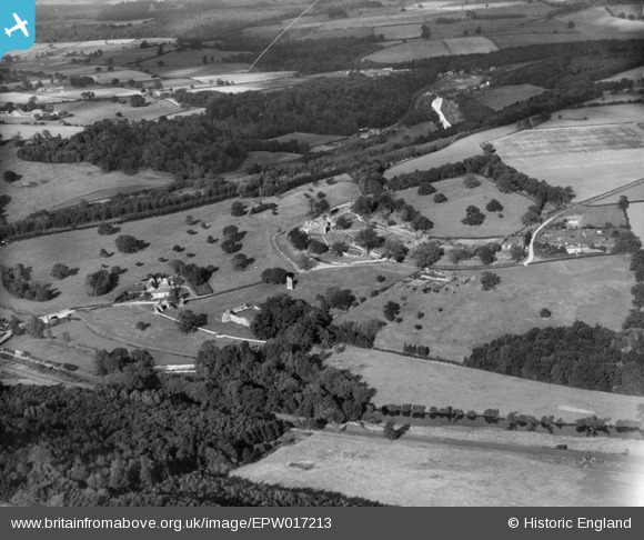
EPW017213 ENGLAND (1926). Kirkham Hall and Priory, Kirkham, from the south, 1926
© Copyright OpenStreetMap contributors and licensed by the OpenStreetMap Foundation. 2026. Cartography is licensed as CC BY-SA.
Nearby Images (7)
EPW017213

EAW003231

EAW003229

EAW003224

EAW003228

EPW017214

EAW003221

Details
| Title | [EPW017213] Kirkham Hall and Priory, Kirkham, from the south, 1926 |
| Reference | EPW017213 |
| Date | 16-October-1926 |
| Link | |
| Place name | KIRKHAM |
| Parish | WESTOW |
| District | |
| Country | ENGLAND |
| Easting / Northing | 473630, 465730 |
| Longitude / Latitude | -0.87438235153008, 54.082035198975 |
| National Grid Reference | SE736657 |
Pins
Be the first to add a comment to this image!