
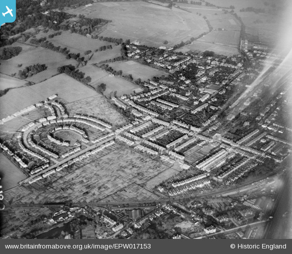
EPW017153 ENGLAND (1926). The Crescent and environs, New Malden, 1926
© Copyright OpenStreetMap contributors and licensed by the OpenStreetMap Foundation. 2026. Cartography is licensed as CC BY-SA.
Nearby Images (4)
EPW017153

EPW016632

EPW016628

EPW017158

Details
| Title | [EPW017153] The Crescent and environs, New Malden, 1926 |
| Reference | EPW017153 |
| Date | October-1926 |
| Link | |
| Place name | NEW MALDEN |
| Parish | |
| District | |
| Country | ENGLAND |
| Easting / Northing | 520716, 168898 |
| Longitude / Latitude | -0.26424778174674, 51.40575013329 |
| National Grid Reference | TQ207689 |
Pins

New Malden |
Thursday 2nd of February 2017 02:59:53 PM | |
|
New Malden |
Thursday 2nd of February 2017 02:58:16 PM | |
|
Kimmy |
Tuesday 1st of March 2016 11:53:41 PM | |
|
Cathy D |
Tuesday 15th of September 2015 04:12:44 PM | |
|
John Wass |
Sunday 24th of May 2015 04:40:32 PM | |
|
John Wass |
Thursday 26th of March 2015 03:00:27 PM |