
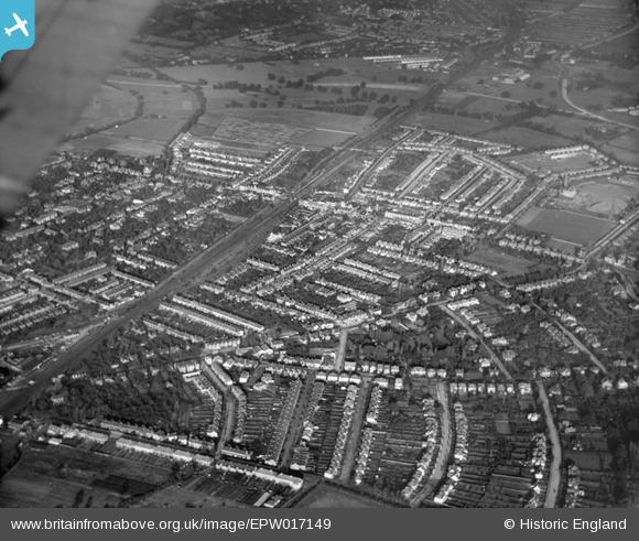
EPW017149 ENGLAND (1926). The town and railway line, New Malden, from the south-west, 1926
© Copyright OpenStreetMap contributors and licensed by the OpenStreetMap Foundation. 2026. Cartography is licensed as CC BY-SA.
Nearby Images (2)
EPW017149

EPW017148

Details
| Title | [EPW017149] The town and railway line, New Malden, from the south-west, 1926 |
| Reference | EPW017149 |
| Date | October-1926 |
| Link | |
| Place name | NEW MALDEN |
| Parish | |
| District | |
| Country | ENGLAND |
| Easting / Northing | 520844, 168131 |
| Longitude / Latitude | -0.26266951016546, 51.398828674693 |
| National Grid Reference | TQ208681 |
Pins

Dom |
Wednesday 30th of August 2023 02:34:10 PM | |
|
Dom |
Tuesday 9th of March 2021 11:05:16 AM | |
|
Dom |
Tuesday 9th of March 2021 11:03:46 AM | |
|
David |
Sunday 29th of March 2015 09:44:48 PM | |
|
John Wass |
Thursday 26th of March 2015 02:57:47 PM | |
 8-2007.JPG)
Keith |
Thursday 5th of July 2012 06:58:42 PM |