
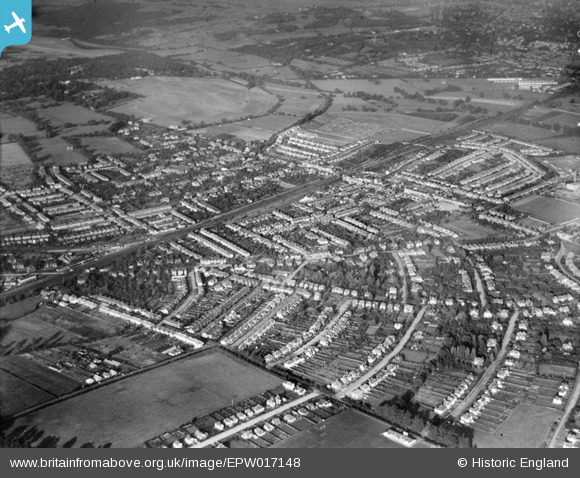
EPW017148 ENGLAND (1926). The town and railway line, New Malden, from the south-west, 1926
© Copyright OpenStreetMap contributors and licensed by the OpenStreetMap Foundation. 2025. Cartography is licensed as CC BY-SA.
Nearby Images (2)
EPW017148

EPW017149

Details
| Title | [EPW017148] The town and railway line, New Malden, from the south-west, 1926 |
| Reference | EPW017148 |
| Date | October-1926 |
| Link | |
| Place name | NEW MALDEN |
| Parish | |
| District | |
| Country | ENGLAND |
| Easting / Northing | 520779, 168141 |
| Longitude / Latitude | -0.26360012607836, 51.39893240558 |
| National Grid Reference | TQ208681 |
Pins

Johnbg1948 |
Friday 16th of April 2021 08:31:31 PM | |
|
John Wass |
Sunday 24th of May 2015 04:32:42 PM | |
|
David |
Monday 6th of April 2015 07:13:41 PM |