
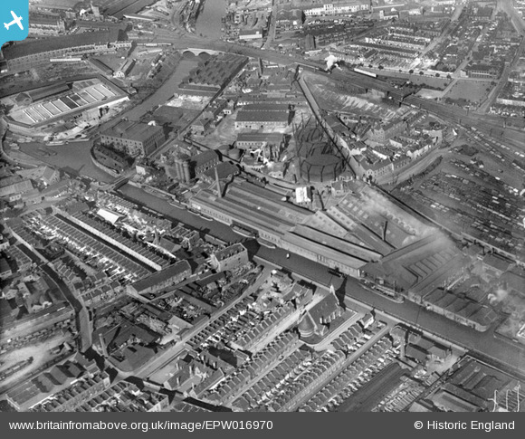
EPW016970 ENGLAND (1926). The Gas Lane Gas Works and factories beside The Feeder, Bristol, 1926
© Copyright OpenStreetMap contributors and licensed by the OpenStreetMap Foundation. 2026. Cartography is licensed as CC BY-SA.
Nearby Images (15)
EPW016970

EAW049917
 Ltd Tar Works by Kingsland Road Sidings and environs, Bristol, from the north-west, 1953. This image was marked by Aerofilms Ltd for photo editing.")
EPW016950

EAW049915
 Ltd Tar Works by Kingsland Road Sidings, Bristol, 1953. This image was marked by Aerofilms Ltd for photo editing.")
EPW016952

EAW049916
 Ltd Tar Works by Kingsland Road Sidings and environs, Bristol, 1953. This image was marked by Aerofilms Ltd for photo editing.")
EAW049910
 Ltd Tar Works by Kingsland Road Sidings, Bristol, 1953. This image was marked by Aerofilms Ltd for photo editing.")
EPW016951

EPW016954

EPW016953

EPW016955

EPW016956

EAW049911
 Ltd Tar Works by Kingsland Road Sidings and surrounding factories along The Feeder, Bristol, 1953. This image was marked by Aerofilms Ltd for photo editing.")
EAW049913
 Ltd Tar Works by Kingsland Road Sidings, Bristol, 1953. This image was marked by Aerofilms Ltd for photo editing.")
EAW049914

Details
| Title | [EPW016970] The Gas Lane Gas Works and factories beside The Feeder, Bristol, 1926 |
| Reference | EPW016970 |
| Date | October-1926 |
| Link | |
| Place name | BRISTOL |
| Parish | |
| District | |
| Country | ENGLAND |
| Easting / Northing | 360242, 172452 |
| Longitude / Latitude | -2.5721974725548, 51.449167173452 |
| National Grid Reference | ST602725 |
Pins

Paul Wick |
Tuesday 2nd of September 2025 08:05:42 PM | |
|
nicaboo |
Sunday 17th of November 2019 05:17:14 PM | |
|
nicaboo |
Sunday 17th of November 2019 05:14:00 PM | |
|
mike |
Monday 6th of October 2014 02:20:37 PM | |
|
david |
Monday 16th of June 2014 10:59:22 AM | |
|
david |
Monday 16th of June 2014 10:50:53 AM | |

Class31 |
Monday 5th of November 2012 08:01:39 PM | |
|
Class31 |
Monday 5th of November 2012 08:01:06 PM | |
|
Class31 |
Monday 5th of November 2012 08:00:24 PM | |
|
Class31 |
Monday 5th of November 2012 07:58:35 PM | |
|
Class31 |
Monday 5th of November 2012 07:57:53 PM | |
|
kent |
Thursday 26th of July 2012 11:35:32 PM | |
|
kent |
Thursday 26th of July 2012 11:33:59 PM | |
|
kent |
Thursday 26th of July 2012 11:32:03 PM |
User Comment Contributions
This is the first picture I have seen with the outside of St Silas Church on Feeder Road which was blitzed and never rebuilt |
ChurchCrawler |
Tuesday 26th of June 2012 09:53:37 AM |