
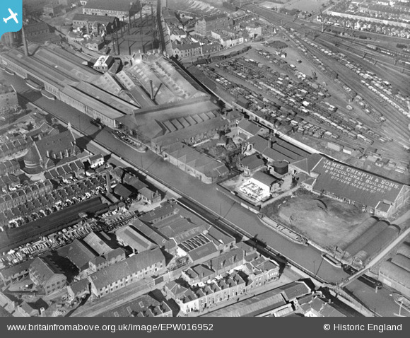
EPW016952 ENGLAND (1926). Works off Silverthorne Lane and St Silas's Church, Bristol, 1926
© Copyright OpenStreetMap contributors and licensed by the OpenStreetMap Foundation. 2026. Cartography is licensed as CC BY-SA.
Nearby Images (16)
EPW016952

EAW049910
 Ltd Tar Works by Kingsland Road Sidings, Bristol, 1953. This image was marked by Aerofilms Ltd for photo editing.")
EPW016951

EPW016953

EPW016954

EPW016955

EPW016950

EPW016956

EAW049911
 Ltd Tar Works by Kingsland Road Sidings and surrounding factories along The Feeder, Bristol, 1953. This image was marked by Aerofilms Ltd for photo editing.")
EAW049912
 Ltd Tar Works by Kingsland Road Sidings, Bristol, 1953. This image was marked by Aerofilms Ltd for photo editing.")
EAW049913
 Ltd Tar Works by Kingsland Road Sidings, Bristol, 1953. This image was marked by Aerofilms Ltd for photo editing.")
EAW049915
 Ltd Tar Works by Kingsland Road Sidings, Bristol, 1953. This image was marked by Aerofilms Ltd for photo editing.")
EAW049917
 Ltd Tar Works by Kingsland Road Sidings and environs, Bristol, from the north-west, 1953. This image was marked by Aerofilms Ltd for photo editing.")
EAW049914

EAW049916
 Ltd Tar Works by Kingsland Road Sidings and environs, Bristol, 1953. This image was marked by Aerofilms Ltd for photo editing.")
EPW016970

Details
| Title | [EPW016952] Works off Silverthorne Lane and St Silas's Church, Bristol, 1926 |
| Reference | EPW016952 |
| Date | 25-September-1926 |
| Link | |
| Place name | BRISTOL |
| Parish | |
| District | |
| Country | ENGLAND |
| Easting / Northing | 360446, 172508 |
| Longitude / Latitude | -2.5692679213234, 51.449685024 |
| National Grid Reference | ST604725 |
Pins

david |
Monday 16th of June 2014 11:32:31 AM | |
|
david |
Monday 16th of June 2014 11:30:19 AM | |
|
david |
Monday 16th of June 2014 10:46:49 AM | |
Got it |
Barbie Lee |
Thursday 19th of June 2014 09:41:31 AM |

Class31 |
Saturday 16th of February 2013 10:34:11 PM | |
|
MB |
Monday 21st of January 2013 12:00:00 AM | |
|
Class31 |
Tuesday 20th of November 2012 09:36:55 AM | |
|
Class31 |
Tuesday 20th of November 2012 09:36:35 AM | |
|
Class31 |
Tuesday 20th of November 2012 09:36:16 AM |