
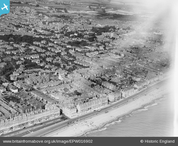
EPW016902 ENGLAND (1926). Marine Parade and residential area, Worthing, from the south-west, 1926
© Copyright OpenStreetMap contributors and licensed by the OpenStreetMap Foundation. 2026. Cartography is licensed as CC BY-SA.
Nearby Images (9)
EPW016902

EPW011527

EPW000709

EPW054070

EPW020180

EPW011528

EPW018283

EPW000241

EPW042997

Details
| Title | [EPW016902] Marine Parade and residential area, Worthing, from the south-west, 1926 |
| Reference | EPW016902 |
| Date | August-1926 |
| Link | |
| Place name | WORTHING |
| Parish | |
| District | |
| Country | ENGLAND |
| Easting / Northing | 514211, 102313 |
| Longitude / Latitude | -0.37882133421037, 50.808534505197 |
| National Grid Reference | TQ142023 |
Pins
Be the first to add a comment to this image!