
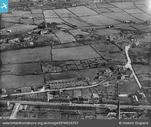
EPW016757 ENGLAND (1926). Christ Church, Royds Avenue and environs, Linthwaite, 1926
© Copyright OpenStreetMap contributors and licensed by the OpenStreetMap Foundation. 2026. Cartography is licensed as CC BY-SA.
Nearby Images (7)
EPW016757

EAW002575

EPW016756

EAW002579

EAW002574

EAW002578

EAW002573

Details
| Title | [EPW016757] Christ Church, Royds Avenue and environs, Linthwaite, 1926 |
| Reference | EPW016757 |
| Date | August-1926 |
| Link | |
| Place name | LINTHWAITE |
| Parish | |
| District | |
| Country | ENGLAND |
| Easting / Northing | 410020, 414502 |
| Longitude / Latitude | -1.8484760415579, 53.626719901199 |
| National Grid Reference | SE100145 |
Pins

JohnB57 |
Saturday 2nd of April 2016 03:32:42 PM | |
|
guinness523 |
Monday 10th of August 2015 09:32:18 PM | |
|
guinness523 |
Monday 10th of August 2015 09:23:45 PM |
User Comment Contributions
Hoyle Ing |
Stan |
Friday 6th of February 2015 07:47:37 PM |