
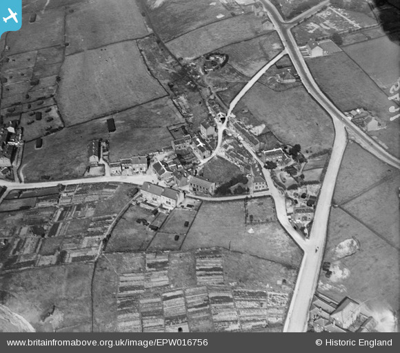
EPW016756 ENGLAND (1926). Lane Top, Linthwaite, 1926
© Copyright OpenStreetMap contributors and licensed by the OpenStreetMap Foundation. 2026. Cartography is licensed as CC BY-SA.
Nearby Images (2)
EPW016756

EPW016757

Details
| Title | [EPW016756] Lane Top, Linthwaite, 1926 |
| Reference | EPW016756 |
| Date | August-1926 |
| Link | |
| Place name | LINTHWAITE |
| Parish | |
| District | |
| Country | ENGLAND |
| Easting / Northing | 410022, 414299 |
| Longitude / Latitude | -1.8484523349708, 53.624895047072 |
| National Grid Reference | SE100143 |
